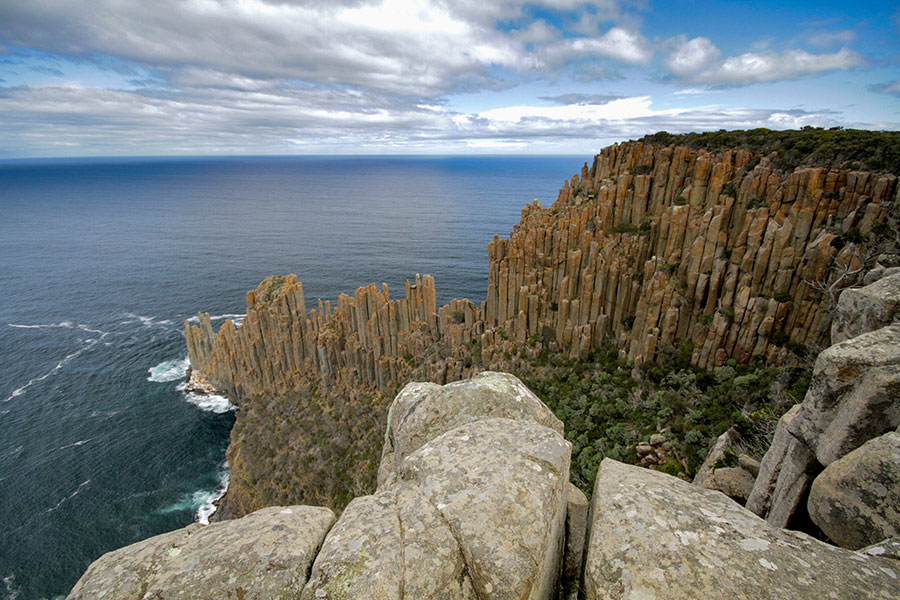
Dried gum leaves crunch underfoot as I make my way through a forest of rustling eucalypts. My guide, photographer Pete Harmsen, leads the way, his camera swinging on its strap with each step. At the top of the hill, he beckons me forward to where the land drops away, revealing a knee-weakening view of Tasmania’s soaring southern coast – sheer cliffs of green-tufted grey and gold stretching far into the distance.

This is Cape Raoul, one of the Three Capes of Tasmania’s famous walking trail, yet compared to its eastern cousins, Capes Pillar and Hauy, this remarkable peninsula receives a fraction of the visitors. “It’s becoming better known now, but it’s still possible to have it all to yourself,” Pete says, lifting his camera to take a shot.
As a photographer, Pete relishes the variety in this seven-kilometre walk, from the waving gums to fern-thick temperate rainforest, a broad plateau where sun-bleached trees lean flat to the ground, and of course, our destination – the very point of Cape Raoul, where towering columns of dolerite thrust up from the water like colossal, rust-tipped spears.


Here, we are surrounded on three sides by the Southern Ocean, and stand to watch the clouds scudding and roiling on the horizon, throwing a patchwork of shadows onto the water below. “That’s Storm Bay,” Pete says, gesturing towards the east, “and it’s a good name – you get a lot of wild weather in this part of the world, and you see it all from up here. It’s never the same view from one moment to the next.”
As if it has heard him, the wind grows suddenly stronger and the clouds draw in. Turning reluctantly from the view, we make our way back under a leadening sky, leaving Cape Raoul to the wild winds and surf it has stood fast against for millennia.


 Three Capes of Tasmania walking trail is a seven-kilometre walk, from the waving gums to fern-thick temperate rainforest. (Photography by Pete Harmsen)